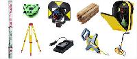
Our Products


Garmin eTrex 10Handheld GPS retains the core functionality, rugged construction, affordability and long battery life that made eTrex the most dependable GPS device available. We improved the user interface and added a worldwide basemap, paperless geocaching and support for spine-mounting accessories.
Rugged Handheld GPS with Enhanced Capabilities
Garmin eTrex 10retains the core functionality, rugged construction, affordability and long battery life that made eTrex the most dependable GPS device available. We improved the user interface and added a worldwide basemap, paperless geocaching and support for spine-mounting accessories.
See the WayGarmin eTrex 10 GPS has an enhanced 2.2 monochrome display thats easy to read in any lighting situation. Both durable and water resistant, eTrex 10 is built to withstand the elements. Its easy-to-use interface means youll spend more time enjoying the outdoors and less time searching for information. eTrex 10 features the legendary toughness thats built to withstand the elements. Dust, dirt, humidity, water none are a match for this navigator.
Find Fun
eTrex 10supports geocaching GPX files for transferring geocaches. Visit OpenCaching to start your geocaching adventure. By going paperless, youre not only helping the environment but also improving efficiency. eTrex 10 stores and displays key information, including location, terrain, difficulty, hints and descriptions, which means no more manually entering coordinates and paper printouts. Simply upload the GPX file to your eTrex 10 and start hunting for caches.
Keep Your FixWith its high-sensitivity, WAAS-enabled GPS receiver and HotFix satellite prediction, Garmin eTrex 10 handheld GPS locates your position quickly and precisely and maintains its GPS location even in heavy cover and deep canyons. Whether youre in deep woods or just near tall buildings and trees, you can count on eTrex 10 to help you find your way when you need it the most.
Go GlobalGarmin eTrex devices are the first-ever consumer-grade receivers that can track both GPS and GLONASS satellites simultaneously. When using GLONASS satellites, the time it takes for the receiver to lock on to a position is (on average) approximately 20 percent faster than using GPS. And when using both GPS and GLONASS, the receiver has the ability to lock on to 24 more satellites than using GPS alone.
Plan Your Next TripTake charge of your next adventure with BaseCamp, software that lets you view and organize maps, waypoints, routes, and tracks. This free trip-planning software even allows you to create Garmin Adventures that you can share with friends, family or fellow explorers. BaseCamp displays topographic map data in 2-D or 3-D on your computer screen, including contour lines and elevation profiles.
| Physical & Performance | |
|---|---|
| Physical dimensions | 2.1″ x 4.0″ x 1.3″ (5.4 x 10.3 x 3.3 cm) |
| Display size, WxH | 1.4″ x 1.7″ (3.6 x 4.3 cm); 2.2″ diag (5.6 cm) |
| Display resolution, WxH | 128 x 160 pixels |
| Display type | transflective, monochrome |
| Weight | 5 oz (141.7 g) with batteries |
| Batteries | 2 AA batteries (not included); NiMH or Lithium recommended |
| Battery life | 25 hours |
| Water rating | IPX7 |
| High-sensitivity receiver | yes |
| Interface | USB |
| Maps & Memory | |
|---|---|
| Basemap | yes |
| Custom POIs (ability to add additional points of interest) | yes |
| Waypoints/favorites/locations | 1000 |
| Routes | 50 |
| Track log | 10,000 points, 100 saved tracks |
| Outdoor Features | |
|---|---|
| Geocaching-friendly | yes (Paperless) |
| Hunt/fish calendar | yes |
| Sun and moon information | yes |
| Area calculation | yes |
| Garmin Connect™ | |
|---|---|
| Garmin Connect™ compatible (online community where you analyze, categorize and share data) | yes |
| Warranty | One Year Warranty. |

Product Description
Leica FTA360 Tripod Adapter for precise targeting
For precise measurement or levelling task it is important to perfectly position the laser device. Therefore Leica Geosystems offers different types of adapters & clamps for your application needs.
Measuring over long distances requires a stable set-up of the laser distance meter. It is often difficult to fine adjust the laser dot at the target point by holding the device to a stable reference or if mounted on a tripod by moving its head.
Leica Geosystems have addressed this problem by introducing the new FTA360 tripod adapter with fine-adjustment for easy and precise targeting. This new adapter fits with Leica tripods TRI70, TRI100 & TRI200. It supports the new Leica DISTO D810 touch which has a special reference setting for this adapter as well as the Leica DISTO D510, D5, D8 & D810 Touch.
Together with the new FTA360 adapter the Leica DISTO products become highly precise measuring stations.

When working outside, it might be difficult to see the laser line or dot. Special glasses guarantee an optimal visibility of the laser lines and dots in bright conditions and over longer distances. For outside applications with a laser, Leica Geosystems recommends one of its high quality GLB30 laser glasses.

The Leica TRI 200 Tripod is a surveyor style tripod that is more stable and durable. This package is for professionals that frequently measure on uneven grade, in rugged environments and in the elements. The Leica TRI 200 pack includes a soft bag with a carry strap for easy mobility in the field.
The Leica TRI200 Tripod offers a 1/4-inch 20-millimeter male threaded adapter for mounting Leica DISTO*, LINO, and Camera devices. With a similar setup to construction tripods, theLeica TRI 200offers a sturdy platform for accurate measuring or photography. The TRI200 also features rubber feet to protect the working surface. Leica TRI200 tripod includes soft case for easy transport.
*For use with Leica DISTO must also purchase TA360 Adapter, FTA360-S Adapter for Leica S910, & FTA360 Adapter for Leica D810 & D510.*
PRODUCT SPECIFICATION

Leica GZM 26 A4 Size Target Plate
An important condition for achieving a precise measurement with a laser distance meter is a perfect reflecting target. Leica Geosystems offers target plates which can be used to measure long distances or which can be fixed at corners, edges or over floor marks. Other types of target plates are used to locate the line or rotation lasers beams.

Additional Information:
Packaging Details : Survey Instruments Supplier
We deals in all Branded surveying instruments & accessories
Branded:TOPCON LEICA SOKKIA BOSCH GARMIN DGPS, TOTAL STATION, DIGITAL THEODOLITE, AUTO LEVEL, DISTANCE METER, GPS
pradeep@asiinstrumentsindia.com, omsouth@yahoo.com
Mobile:+91-9015653093;011-47014143

Additional Information:
Packaging Details : Mr. Pradeep Kumar (Technical & Marketing Manager)
(ASI)Advanced Surveying Instruments (India) Pvt. Ltd.
Corp. Off.: H-2/313, 3rd Floor, Apra North Ex Plaza, Near SBI Bank
Netaji Subhash Place, Pitam Pura, New Delhi 110 034, India
Mobile : +91-9015653093, 9560961551 Tele : +91-011-47014143
Email : pradeep@asiinstrumentsindia.com, advanced.surveying@yahoo.com