Products / Services
  • Products / Services
  • Companies
  • Buy Leads
    Post Buy Requirement

    Drone Survey Service

    ₹ 400 - ₹ 700 / Acre
    Get Latest Price
    • MOQ1 Acre
    • Business TypeService Provider
    • Preferred Buyer Location India only

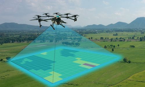
    A drone survey uses unmanned aerial vehicles (UAVs) equipped with sensors like cameras and LiDAR to capture data from above, creating high-resolution maps, 3D models, and other geospatial information. This method is faster, more cost-effective, and safer than traditional surveying, especially for large or hard-to-reach areas. It is used across industries like civil engineering, agriculture, and urban
    Send Enquiry

    Company Information

    • calendar Member Since 1 Year
    • building Nature of Business Service Provider
    • Year of Establishment 2012

    Ask for more detail from the seller

    Contact Supplier
    Report incorrect details
    Share your requirements for a quick response!
    Tell us what you need?
    To list your productBoost Your Business Visibility WorldwideRegister Now
    Waiting for permission
    To search by voice, go to your browser settings and allow access to microphone

    Allow microphone access to search with voice