Our Products
3D Raised Relief Model displays the various terrains in a 3 dimensional space. These can be used to demonstrate rocks & volcanoes, interiors of Earth, air and water pollution, rivers in action (Water Cycle), sea and land breezes, structure of Earth and much more very accurately and efficiently. We supply descriptive 3 D Raised Relief Models to our clients. All these models are made from high quality material and with full precision and accuracy.
3D Raised Relif Models on Geography Size 70x100cms
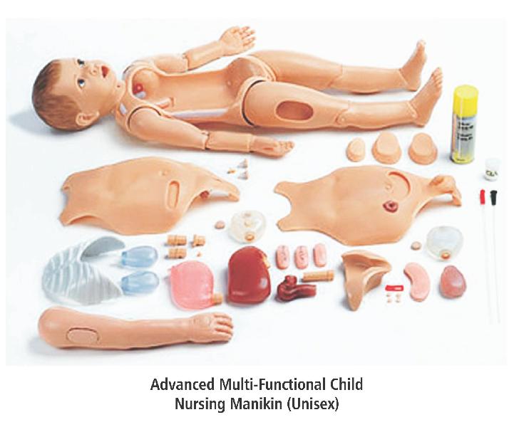
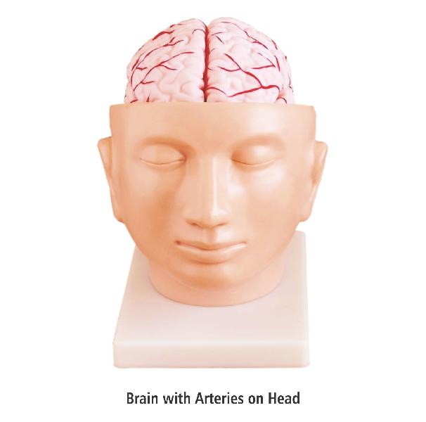
Manufactured using the best available resources, we offer Anatomical Model of elbow bone, skeleton, brain, etc. With immense knowledge and expertise in this domain, we have made our position in the domestic market by providing Anatomical Model. From Chandigarh(India), India, we delight our valuable patrons by providing quality-centralized products.
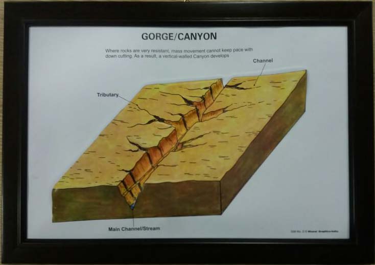
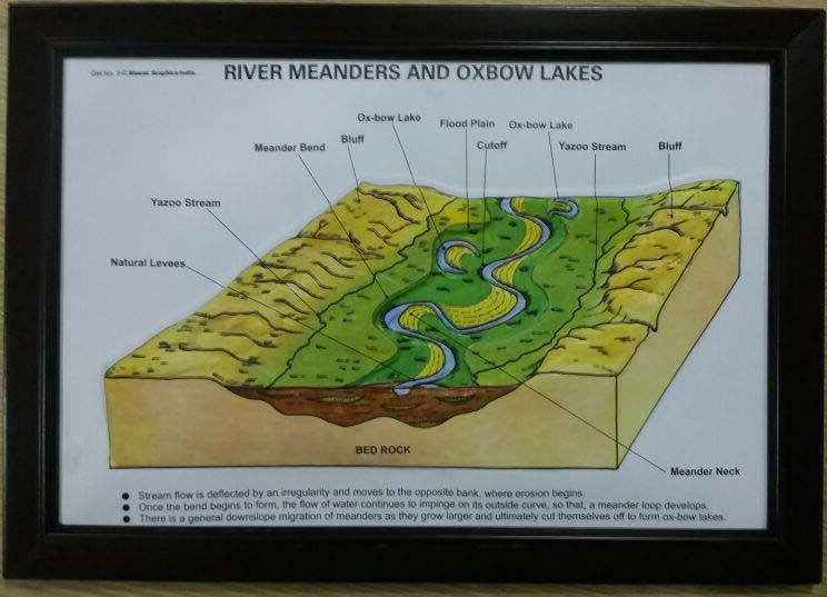
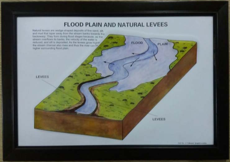
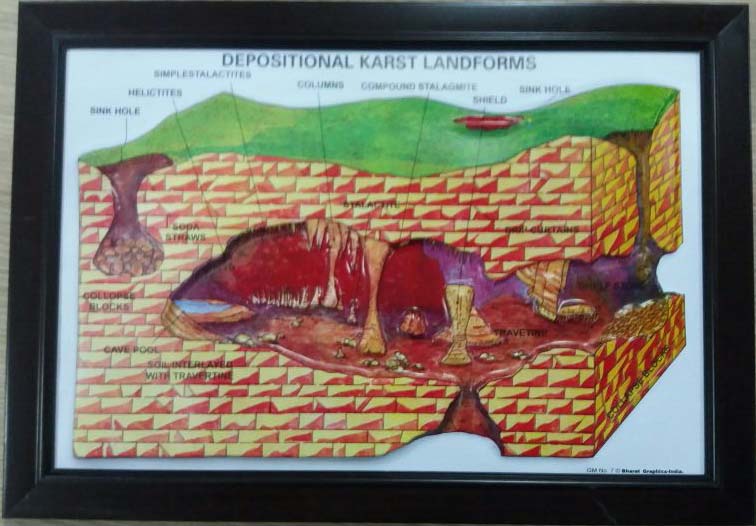
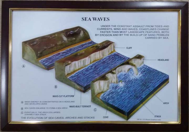
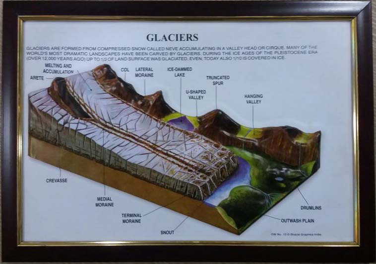
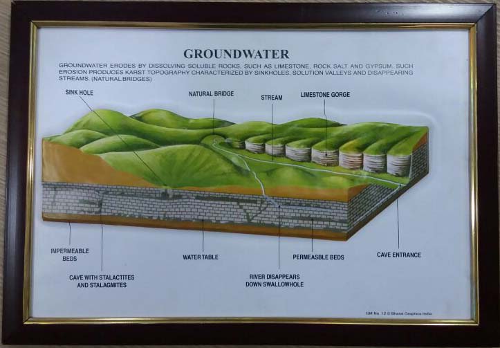
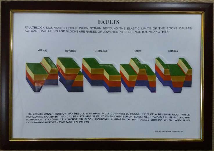
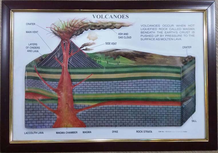
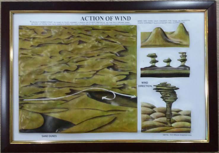
Our GM Raised Relief Model is amongst the most effective ways to describe the actual geological conditions in a particular part of the Earth. Our GM Raised Relief Models are very helpful in displaying glaciers, gorge/canyon, sea waves, rivers meanders, waterfalls, flood plain, Oxbow and Natural Levees, ground water and rift valleys. Action of winds, river deltas, volcanoes, faults and folds can also be easily explained and demonstrated using these GM Raised Relief Models. We supply a great range of GM Raised Relief Models describing different terrains of Earth and their respective situations. We are known for accurate and high quality GM Raised Relief Models.
GM I Set of 8 Ø
GM II Set of 8 Ø
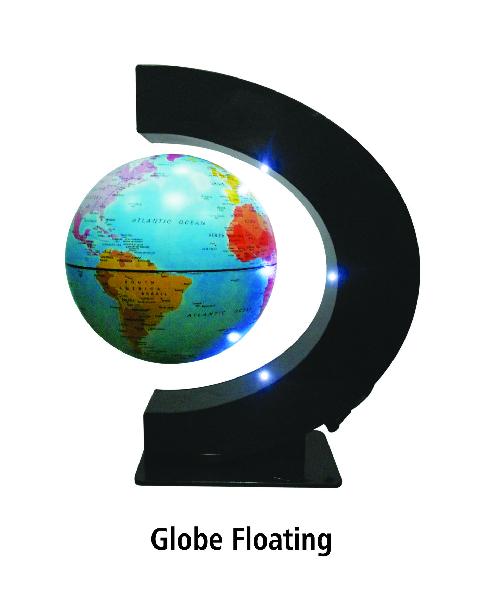
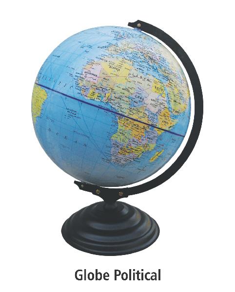
Our Globes are very helpful in understanding and explaining different kinds of terrains and other geographical situations on the Earth. It is helpful for a variety of purposes and allows better understanding of whatever it displays. We are manufacturing world-class Globe Models for the last many years and are supplying them to different areas in Chandigarh, Punjab and the rest of the India and abroad. We are known for our quality products and own a huge client base in different parts of World. Our innovative Globes include Political, Physical, Outline & 3D Globes.
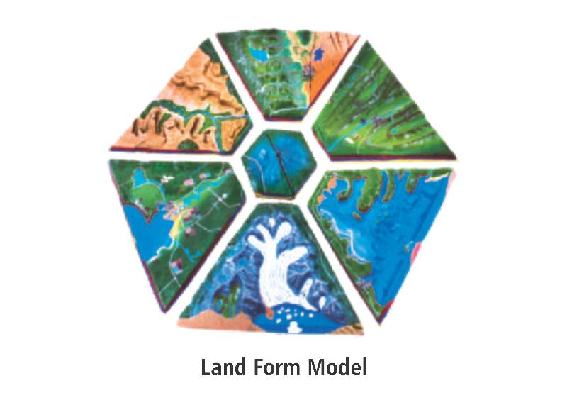
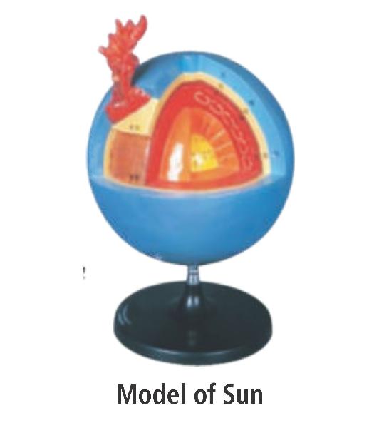
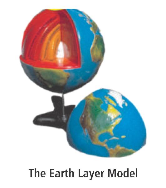
Our Models are Sun Model, The Earth's Layer Model, Rock Cycle Model, Ocean Feature Model, Hydrological Cycle Model, Earth History Model, Land Form Model, Comparative Terrain Model & Alpine Glacier Model
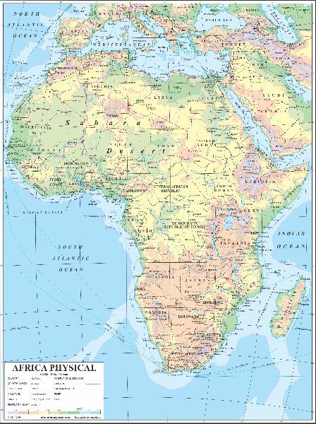
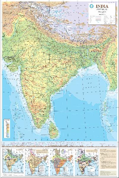
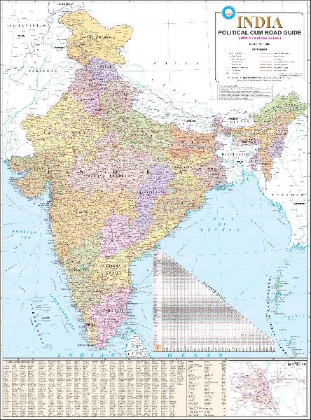
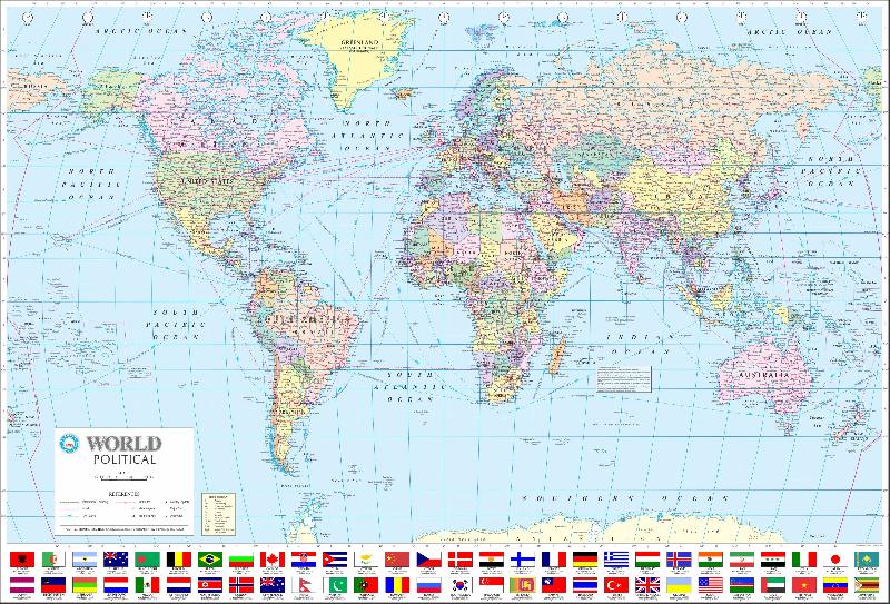
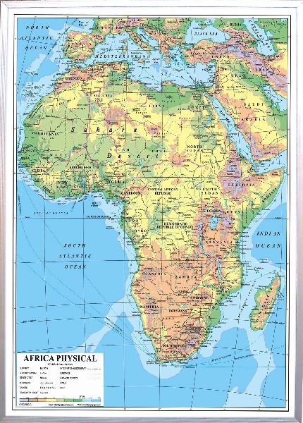
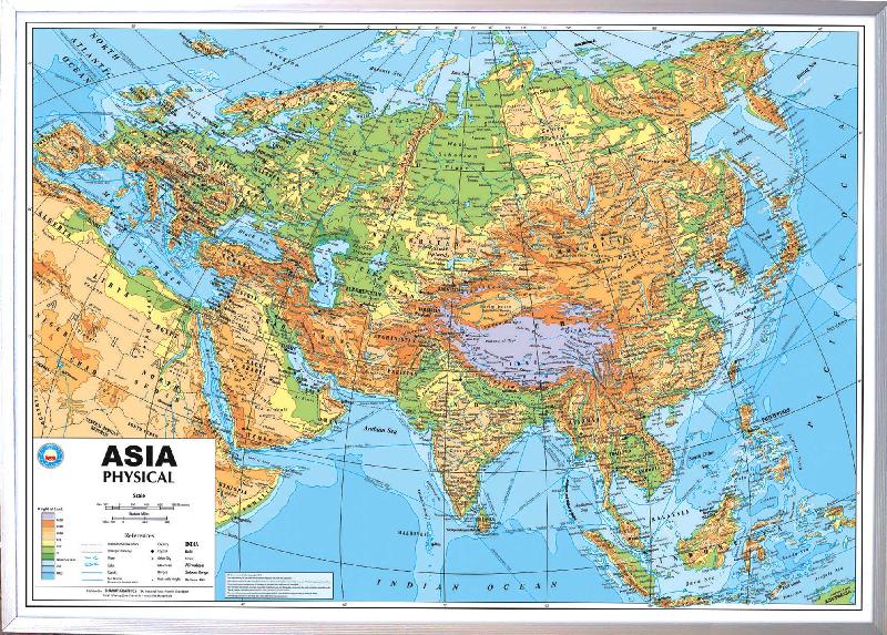
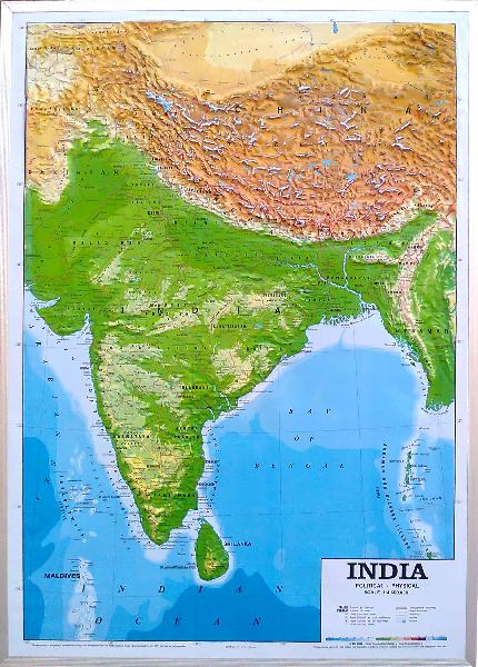
Our Polyart Plastic Maps are extremely helpful in helping understand the geography of a particular region on the Earth. Our Polyart Plastic Maps are heavily used by school teachers, by architects and in the army. These maps are very effective in explaining the details of the area displayed by them. We supply Polyart Plastic Maps for almost all countries and continents in the world. Our range includes both physical and political Polyart Plastic Maps for Africa, Asia, North America, South America, Europe, Australia and their constituent nations. We are into this field for the last many years and are supplying high quality and precise Polyart Plastic Maps to all our clients.
Maps of India - World & Continents. Size 112x162cmsØ
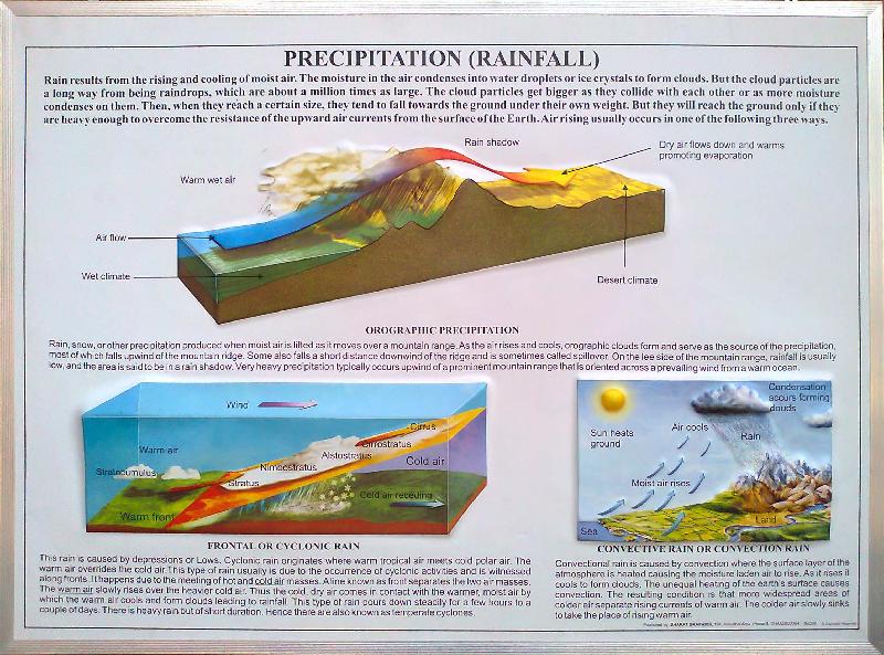
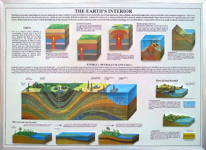
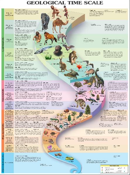
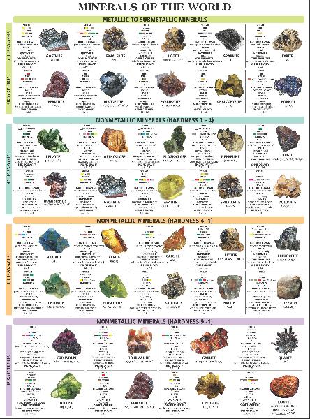
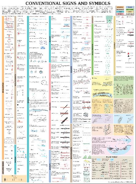
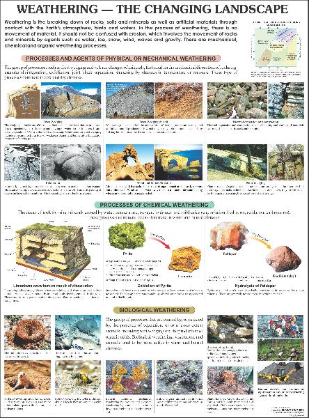
Our Polyart Plastic Geographical Charts are used for a variety of purposes like to describe the Solar System Chart of Volcanoes, how weather changes, interiors of the Earth, different phases of the moon, Solar and Lunar Eclipse, Water Cycle tides, how does the shape of land change, ocean currents, plateau tectonics, continental drifts, etc. These charts are excellent for providing proper insights into these subjects. We manufacture and supply different kinds of Polyart Plastic Geographical Charts to cover almost all subjects that can be explained using these charts.
Life History of a star, Solar System Chart, Volcano chart, Phases of Moon, Interior of Earth, Endangered Earth, How Does Weather changes, How does the shape of Land changes, Solar and lunar Eclipse, Water Cycle, Tides & Ocean Currents, Continental Drift & Plateau Tectonics.
Our 3D Raised Relief Plastic Maps are in huge demand for their immense usage in different areas like education, army, etc. Our 3D Raised Relief Plastic Maps provide proper knowledge about the area at hand and its geographical makeup. People understand different geographical and geological situations easily when these are explained using our 3D Raised Relief Plastic Maps. We are trusted and experienced manufacturers and suppliers of 3D Raised Relief Plastic Maps. We supply these maps at attractive pricing.
Maps of India - World & Continents. Size 70x100cmsØ