Our Services
Our Complete range of products are Geotechnical Investigation Service, Geophysical Survey Service, Bathymetric Survey Services and Topographic Survey Service.

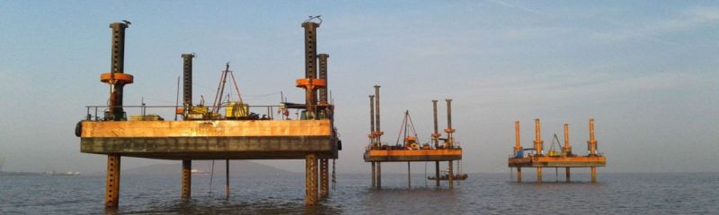
Ideal Geoservices offer geotechnical investigation services for marine, intertidal, and land environments through thorough field and laboratory investigations, which are crucial for your construction and development projects. Our in-depth subsurface explorations include soil sampling, borehole drilling, and geophysical tests to evaluate the properties of soil and rock. Our experienced engineers analyze this data to provide insights on soil stability, bearing capacity, and potential geological hazards. This essential information assists in the design of foundations, ensures slope stability, and guides earthwork planning. With state-of-the-art equipment and rigorous methods, we deliver accurate and reliable results. Depend on us for extensive geotechnical investigations that support safe, efficient, and compliant project management from conception to construction.

Ideal Geoservices offer geophysical survey service provides detailed subsurface analysis for a variety of applications, including environmental studies, mineral exploration, and construction projects. Utilizing advanced technologies such as ground-penetrating radar, seismic reflection, and electromagnetic methods, we deliver precise data on soil composition, groundwater location, and geological structures. Our experienced geophysicists conduct thorough surveys and interpret the results to help you make informed decisions. Whether assessing site suitability or locating natural resources, our services are designed to meet your specific needs efficiently and accurately. Trust us for comprehensive, reliable geophysical surveys that support your project's success and regulatory compliance.

Ideal Geoservices offer bathymetric survey service that delivers precise mapping and analysis of aquatic environments for various applications, including marine construction, navigation, and environmental monitoring. Utilizing advanced sonar systems, GPS, and data processing technology, we provide detailed information on water depth, seabed topography, and underwater features. Our skilled surveyors conduct thorough assessments to ensure accurate and reliable results. Whether you need bathymetric charts, seabed characterization, or underwater hazard identification, our services support safe and efficient marine operations. Trust us for comprehensive hydrographic surveys that meet industry standards and regulatory requirements, ensuring successful project planning and execution in marine and coastal settings.

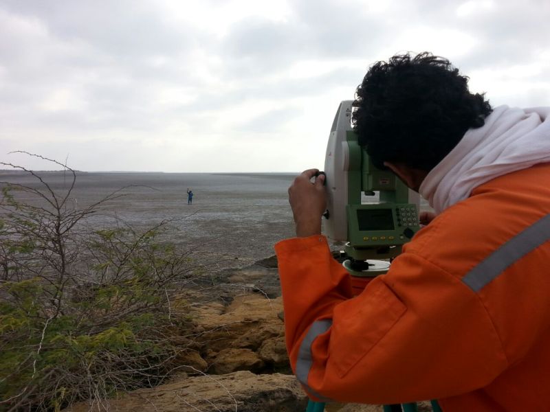
Ideal Geoservices offer topographic survey service offers precise mapping and analysis of terrain for various applications, including urban planning, infrastructure development, and land management. Using cutting-edge surveying technology such as GPS and LiDAR, we capture detailed elevation data, contours, and features to create accurate topographic maps. Our experienced surveyors conduct thorough fieldwork to ensure comprehensive coverage and reliable results. Whether you need site suitability assessments, drainage planning, or land-use studies, our topographic surveys provide valuable insights to support informed decision-making. Trust us for meticulous surveying and mapping services that lay the foundation for successful project planning and execution.