Our Services
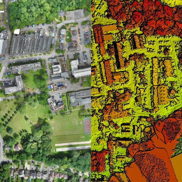
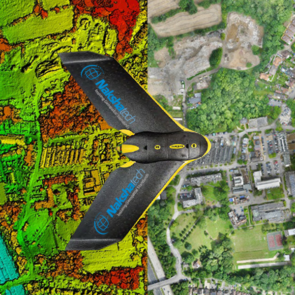
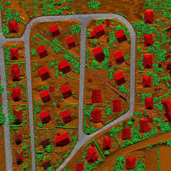
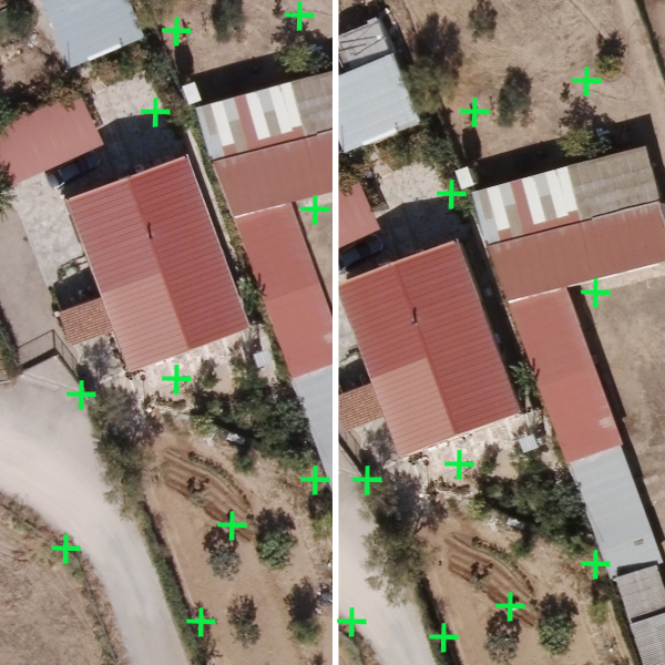
Unmanned aerial vehicles (UAV / Drone) have started to be widely used in Geospatial sector. Naksha Tech produces economic, fast and accurate maps with a drone that has RTK/GPS technology and is specifically designed for surveying.
Naksha Tech owns both Fixed wing and Quad copter UAV’s. Our Drone team successfully executed more than 100 Projects in various sectors.
Applications:
UAV Products:
Where to Apply UAV:
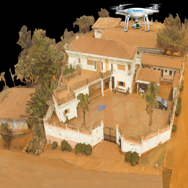
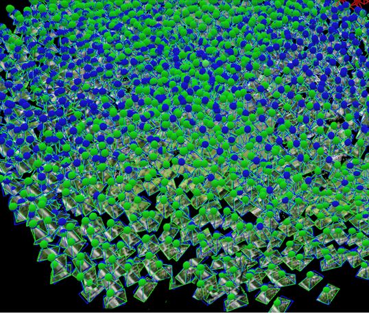
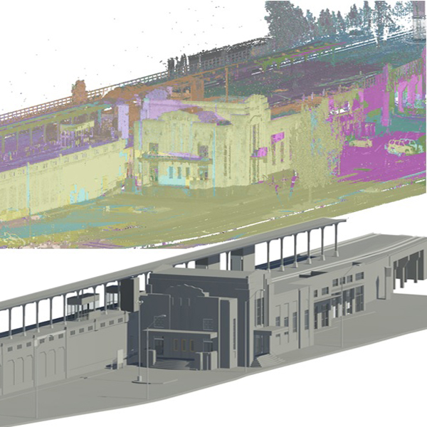
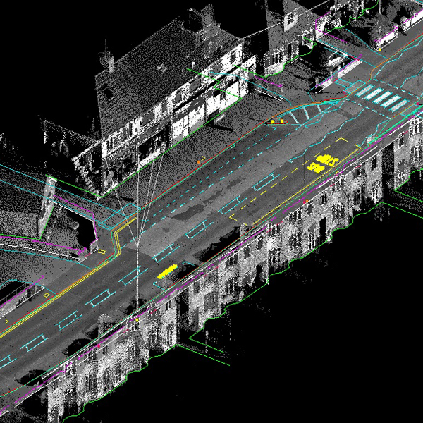
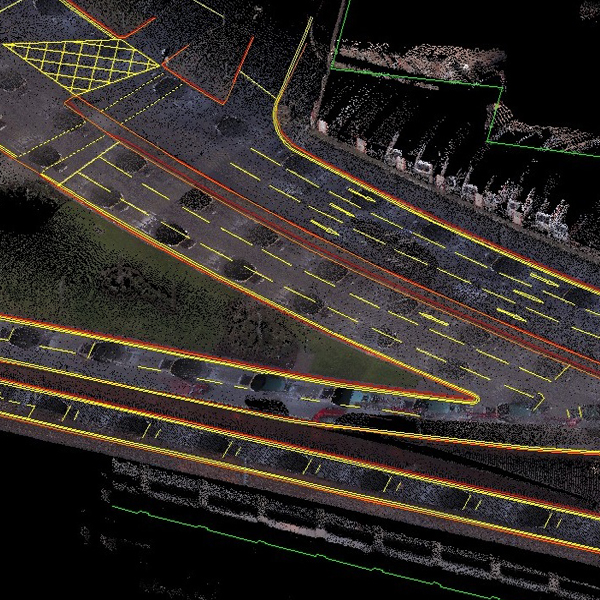
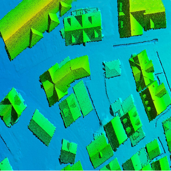
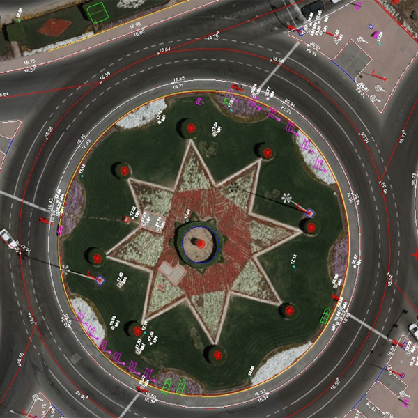
Terrestrial Laser scanning is a new method for surveying tasks, which allows to acquire easy and fast complex geometric data from buildings, machines, objects etc. Each point is determined by the position (x, y, z) and the intensity (i) of the returning signal.
3D laser scanners create “point clouds” of data from the surface of an object. In other words, 3D laser scanning is a way to capture a physical object’s exact size and shape into the computer world as a digital 3-dimensional representation.
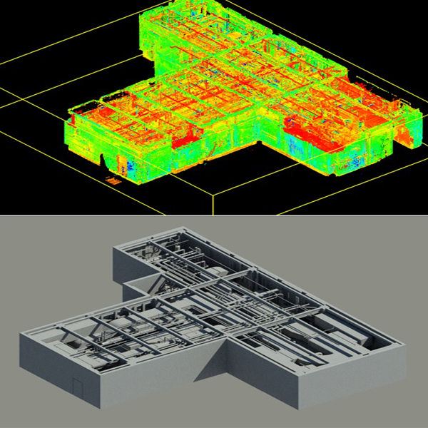
Surveying and Data Processing:Naksha Tech with its expert Team (more than 10 years’ Experience) and up to date Laser Scanning Equipment, our 3D laser scanners collect millions of points-per-second to produce a very dense and accurate collection of individual measurements known as a "point cloud" with a positional accuracy of 6mm. 3D scanning measures existing building interiors and exteriors, interstitial spaces, mechanical, electrical, plumbing, fire protection, pipe networks, construction sites, bridges, historical sites, topography and more. Our processes produce a 2D or 3D CAD model, assuring a dependable starting point for testing and verify design concepts to account for existing conditions and allow for construction coordination.
Terrestrial Laser scanning products:
Where to Apply Terrestrial laser scanning:
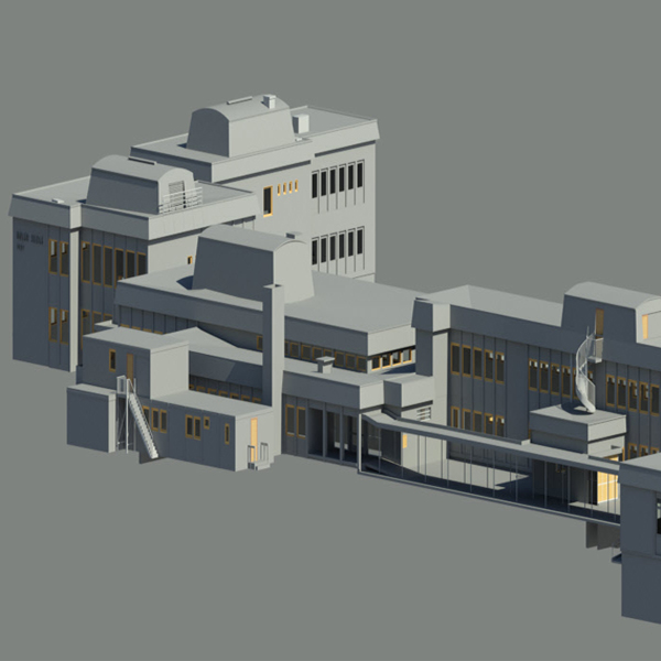
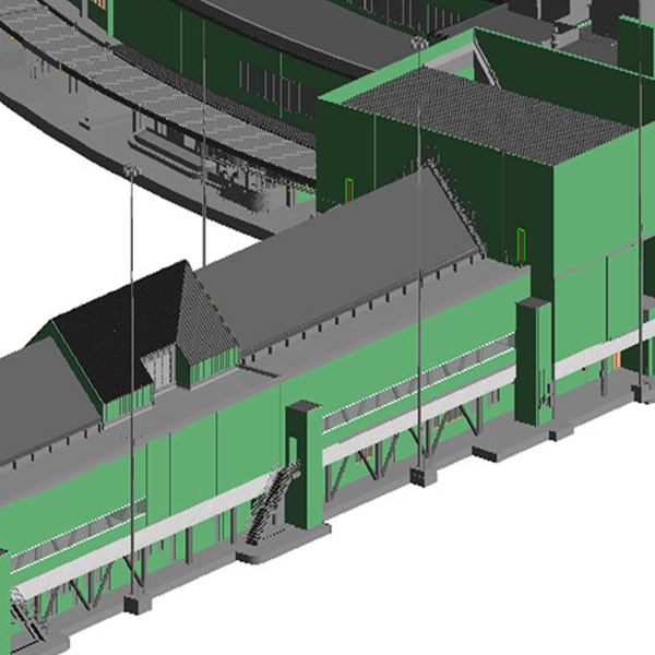
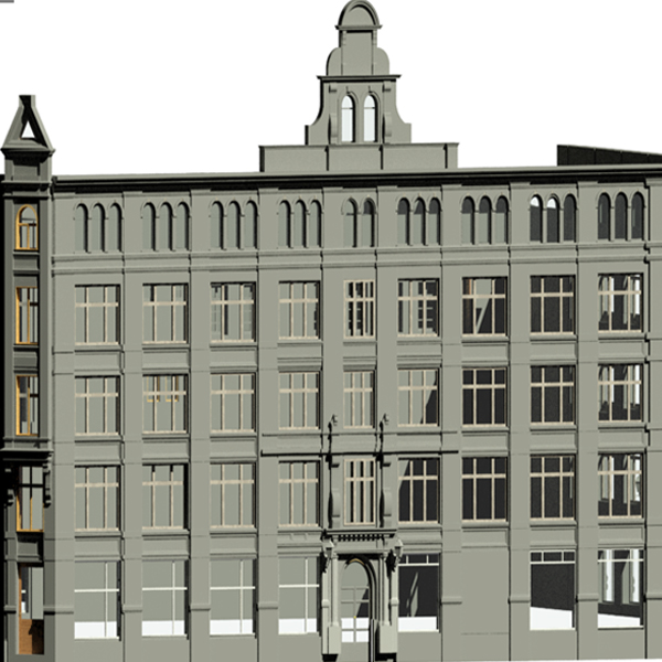
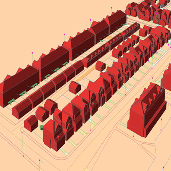
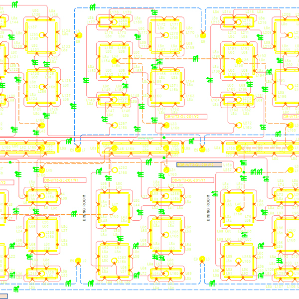
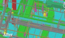
Building Information Modeling (BIM)BIM is a process for creating and managing all of the information on a project – before, during and after construction. The output of this process is the Building Information Model, the digital description of every aspect of the built asset. Laser scanning is the newest method for building information modeling (BIM), offering an accurate, cost-effective and highly integrative means of virtually modeling construction, retrofitting and restoration projects. We are specialized in this industry. We have worked more than 1000 project on BIM modeling like Architectural, Electrical, Structural and Mechanical units.
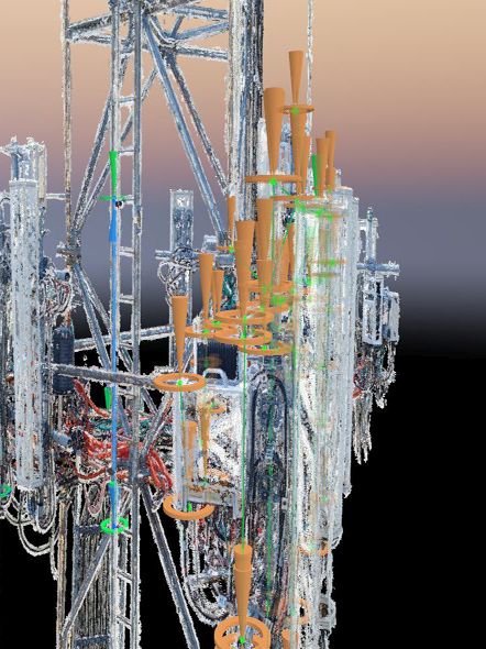
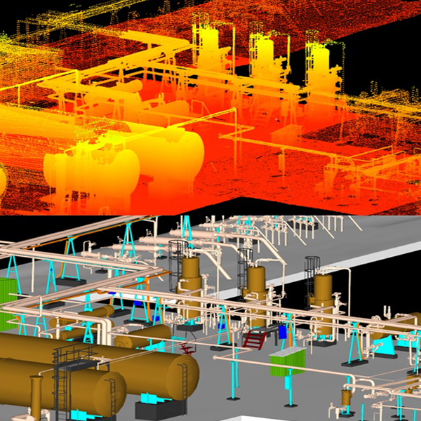
Oil and Gas Industry3D Laser Scanning is the ideal tool for capturing data for Off Shore and On Shore oil and gas plants. Phase and Pulse-based scanners capture complex piping and steel networks for even the most difficult-to-reach areas. The results of 3D laser scanning are tied to the plant's coordinate system and can be directly loaded into most industry leading software including Bentley and Auto-Desk platforms. 3D modeled objects can be created and integrated into various design packages to give a true, real world "as-built" of the facility. This "as-built" model supports design, coordination, facility maintenance, management planning, and future virtual design and construction activities.
Engineering ProjectsAs oppose to the classical methods used in engineering measurements, we provide the most accurate data you need in engineering projects such as highways, dams, tunnels, ship construction, and building facade applications in a very short time period with the help of 3D laser scanning technology.
Laser scanning Work Flow:
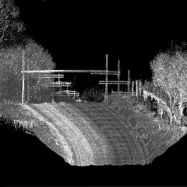
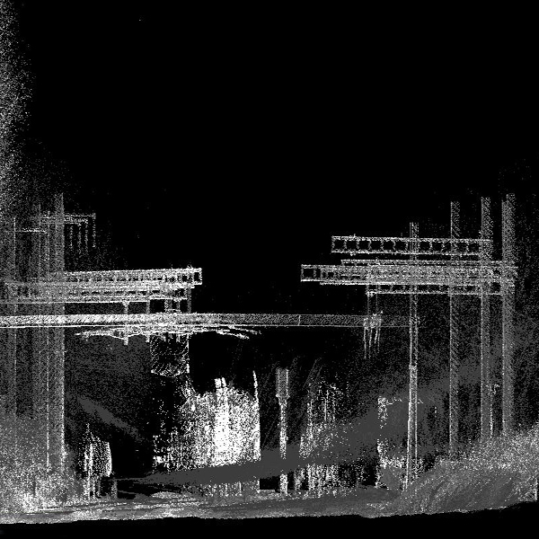
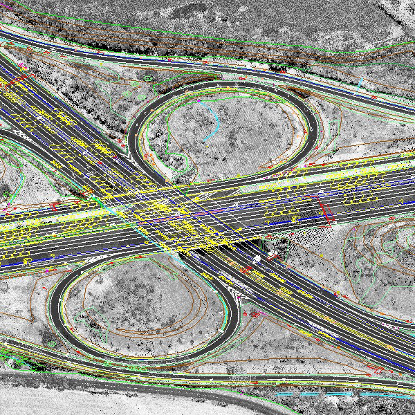
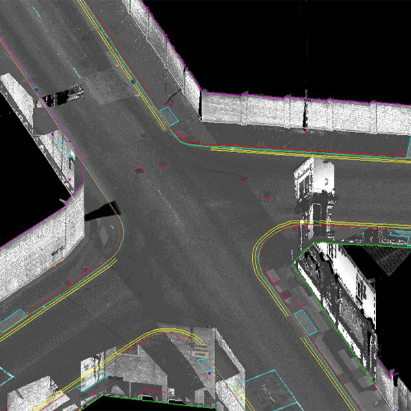
Mobile laser scanning is an emerging technology capable of capturing three-dimensional data from surrounding objects. With state-of-the-art sensors, the achieved point clouds capture object details with good accuracy and precision. Many of the applications involve civil engineering in urban areas, as well as traffic and other urban planning, all of which serve to make 3D city modeling probably the fastest growing market segment in this field In the last couple of years mobile mapping systems have come of age with drastically reduced costs and vastly improved accuracy and speed of data collection. Digital Surveys work with a number of mobile systems depending on project requirements such as accuracy and overall budget costs.
We have systems that range from accuracies of +/- 100mm to +/- 20mm. Mobile mapping systems are transforming how large scale road and city mapping projects are executed. Data can be captured at speeds of 50 mph allowing vast swathe of motorway to be accurately captured faster than ever before.
Naksha Tech MLS data processing team are highly skilled in mapping point cloud data.
Products:
Where to Apply Mobile laser scanning:
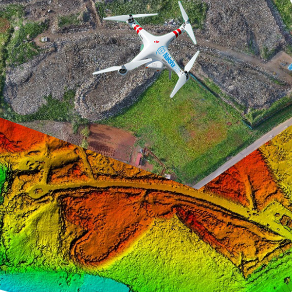
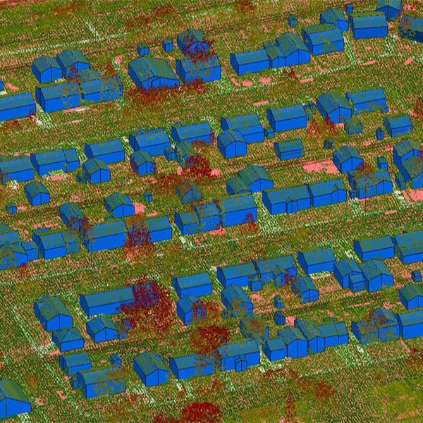
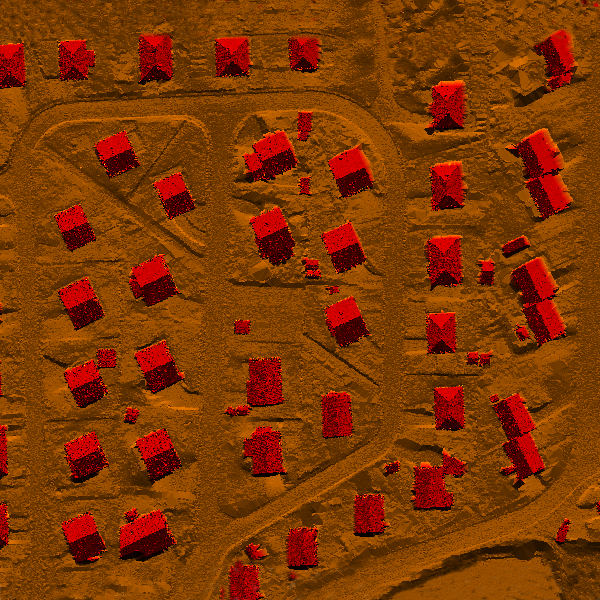
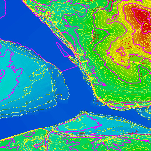
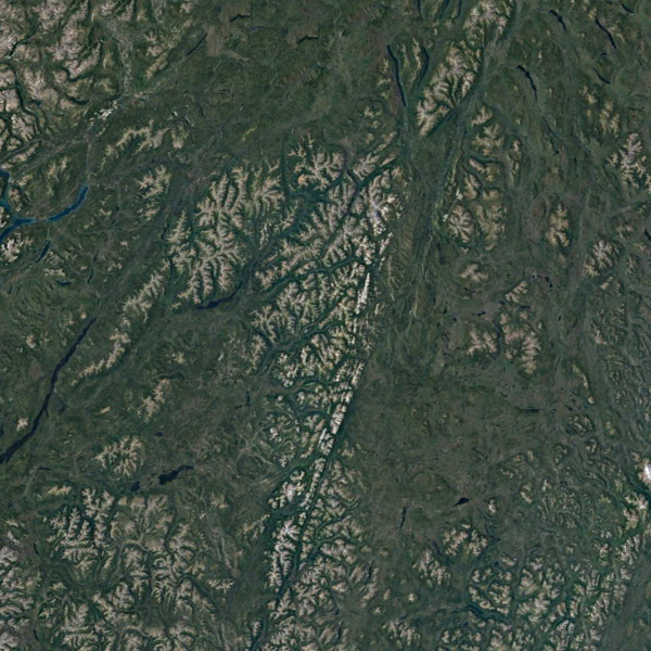
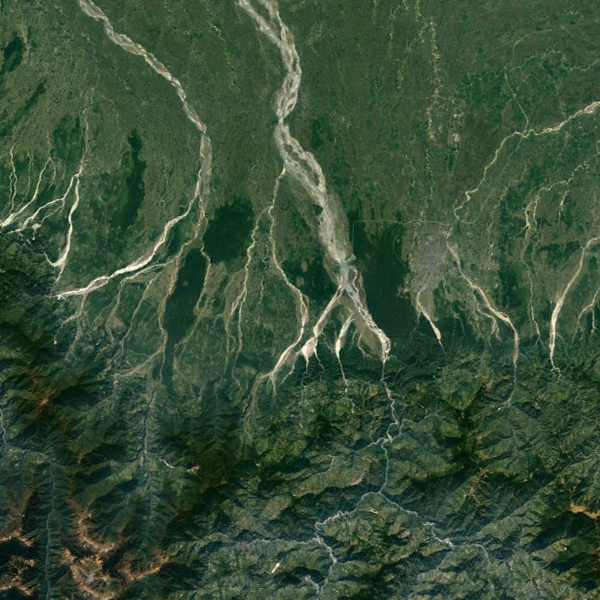
Airborne Lidar makes possible to map very wide areas in a short time period and lower cost with no compromise on the accuracy of measurements.
Naksha tech provides full range of Airborne LiDAR data processing services. Naksha tech’s experienced Engineer’s (more than 15 years’ experience) subjects the collected data to a rigorous quality control review process – including data density, terrain variation analysis, data anomaly filtering, review of 3D/perspective views and review against corresponding digital orthophotography (where available).
We develop fast and economic solutions in producing corridor type maps for land survey and planning of projects including pipe lines, power lines, highways, and railways; hydrographic works such as flood disaster analysis; and producing risk maps for natural disasters such as landslides.
Airborne Lidar Products
Where to Apply Airborne Lidar:
Energy:The data obtained from the point cloud is used for the most appropriate location analysis for Electric High & Low Tension Power Line, solar and wind power plants through the clearance analysis and the minimum distance approach analysis. Also, Airborne Lidar data helps to generate energy corridor and solar energy potentiality maps.
Smart City Planning:
Transportation:Airborne Lidar technology is effectively used in corridor mapping of highways, railways, and pipelines. Airborne Lidar data makes possible very detailed analyses through the corridor for transportation planning.
Forest management
Information required for stance mapping and the calculation inheritance such as height of a tree, crown diameter of a tree, number of trees can be economically and quickly retrieved from the Airborne Lidar data. In addition, topography beneath a forest can be obtained in detail.
Construction:
Base maps, Volume calculation of Ores in Mining Sector, Half yearly change detection of mining Zone, Urban Transformation, Infrastructure projects, Hydro Projects like Channel, dam construction.
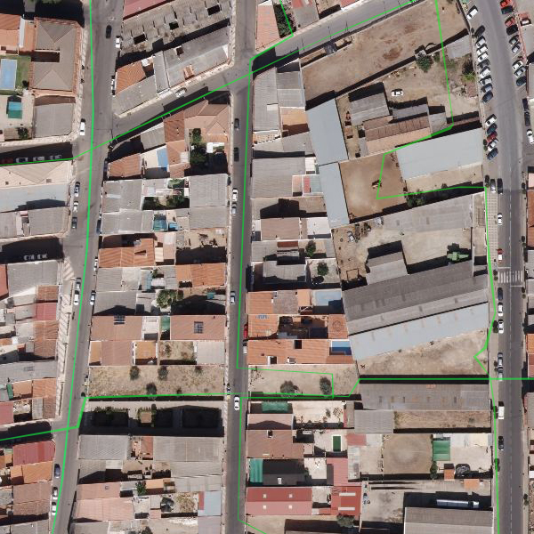
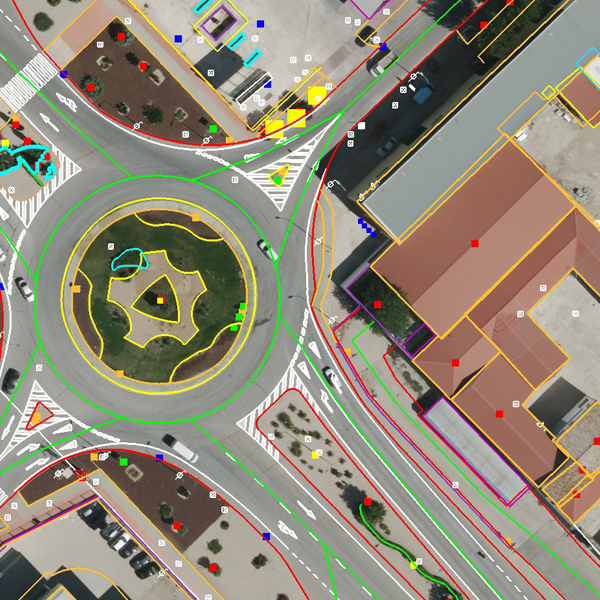
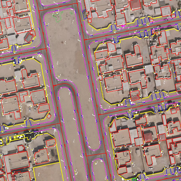
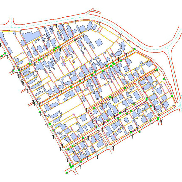
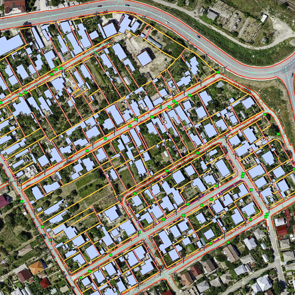
Digital photogrammetry is the art of using computers to obtain the measurements of objects in a photograph. It typically involves analyzing one or more existing photographs or videos with photogrammetric software to determine spatial relationships. Used to create topographical maps, it may also be useful in a variety of industries.
Naksha Tech’s team of Photogrammettrist create quality Vector data and ortho-photos with assured spatial accuracies. To achieve completeness and accuracy of each project, Naksha tech uses specific quality control and quality assurance team to meet client needs. They make sure their outputs are done right with an extensive quality control methodology.
We provide the following photogrammetric offering to meet our clients’ needs.
Aerial triangulation
Digital Orthophotography:
Digital Photogrammetry Products:
Naksha tech can receive the inputs of various domains such as Cadastral maps, Utility maps, Geology maps and Engineering or Architectural drawing in paper or a scanned image format. We will digitize/convert these maps to digital format according to technical specification provided by the client. We offers and deliver the quality output in various formats as per the client requirements.
Naksha tech will follow the international data creation standards along with defined project process methodology to ensure the quality of the deliverables.
Naksha tech team has an immense experience in executing large GIS data conversion projects. Our technically strong experts work closely with the clients to identify their unique needs and provide the GIS data conversion services beyond the customer expectation.
Our data conversion services includes the following:
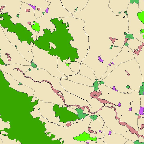
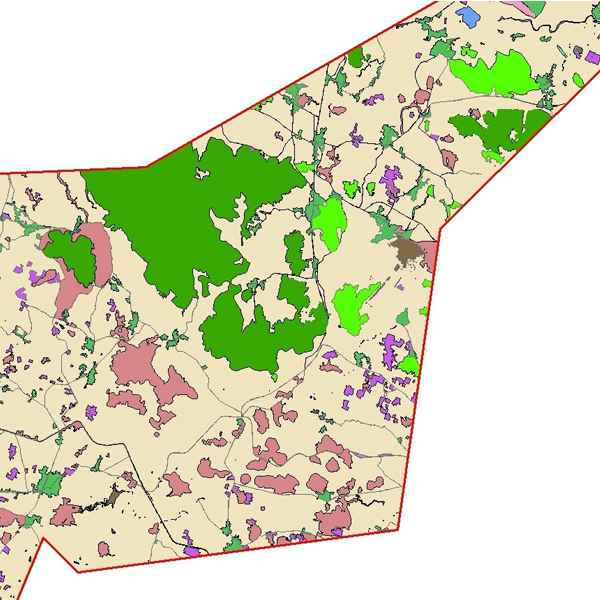
Remote Sensing is a technology of obtaining information about an object without a physical contact with the object but with a sensor mounted on an aircraft or a satellite. The underlying concept is that the sensor either detects the natural radiation that is emitted or reflected by the object (Passive Remote Sensing) or emits energy to scan objects and measure the radiation that is backscattered from the object (Active Remote Sensing) .The advantage of Remote Sensing is that it makes it possible to collect data even in inaccessible areas.
Remote Sensing has numerous applications and not limited to the management of various resources like agriculture, forestry, geology, water, ocean, mining, mineral exploration etc. With the availability of high resolution satellites in recent years, the applications have grown. Few of the most common applications include, Land use/Land cover MappingFlood Mapping/MonitoringCoastal Zone studiesMilitary IntelligenceMeteorology, Earth Science & more
The output of a remote sensing system is usually an image representing the scene being observed. But this digital image is to be processed further so as to extract useful information. Naksha tech has a department handling the remotely sensed digital images often involving the image correction, enhancement and classification (categorizes all pixels in an image into land cover classes or themes). The professionals at Naksha tech appreciate the immense value of this technology and were the supplying the customers of geospatial sector with a valuable information to meet their needs.
Scanning converts paper maps into digital format by capturing features as individual cells, or pixels, producing an automated image.
Maps are generally considered the backbone of any GIS activity. But many a time paper maps are not easily available in a form that can be readily used by the computers. Most of the paper maps had been prepared on the basis of old conventional surveys. New maps can be produced using improved technologies but this requires time as it increases the volume of work. Thus, we have to resort to the available maps. These paper maps have to be first converted into a digital format usable by the computer. This is a critical step as the quality of the analog document must be preserved in the transition to the computer domain. The technology used for this kind of conversions is known as scanning and the instrument used for this kind of operation is known as a scanner. Scanning automatically captures map features, text, and symbols as individual cells, or pixels, and produces an automated image.
Secure document scanning services for Private and government organizations. Naksha Tech provides secure, reliable digitized images to the clients.
We offers competitive pricing and the capacity to turn work around quickly, accurately and in high volume.
Naksha Tech Offers:
Naksha Tech Digitizes Numerous Media Types:
Formats for storing the digitized masters of historical documents and maps:
If you are searching for a trusted 3D laser scanning services in Karnataka (India), then contact us. This is a unique technology that is non-contact, non-destructive that digitally captures the shape of the physical objects. The system makes use of a laser light and the scanners create the “point clouds” of data from the object’s surface. Our service will provide you the exact size and shape of any physical object into the computer in the form of digital 3-dimensional representation.