-1749191681-8116366.jpeg)

Company Information
Ask for more detail from the seller
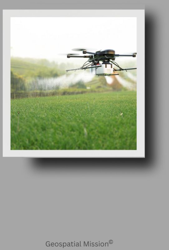
Contact SupplierDrones: Revolutionizing Technology and Industry A drone, also known as an Unmanned Aerial Vehicle (UAV), is an aircraft without a human pilot on board. Controlled either remotely by a human operator or autonomously through onboard computers, drones have rapidly evolved from military tools into versatile devices used across numerous industries worldwide. Types of Drones Drones come in various shapes and sizes, classified mainly by their design and function: Multi-Rotor Drones These drones have multiple rotors—typically four (quadcopters), six (hexacopters), or eight (octocopters)—providing excellent maneuverability and hovering capability. They are widely used for photography, inspection, and recreational purposes. Fixed-Wing Drones With airplane-like wings, fixed-wing drones can cover longer distances and remain airborne longer than multi-rotors. They are commonly employed in agriculture, mapping, and environmental monitoring. Single-Rotor Helicopters These drones resemble traditional helicopters with one main rotor and a tail rotor. They have longer flight times and higher payload capacities but are mechanically more complex. Hybrid VTOL (Vertical Take-Off and Landing) Drones Combining features of fixed-wing and multi-rotor drones, these UAVs can take off and land vertically but fly efficiently over long distances. Core Technologies in Drones Drones integrate several key technologies: Flight Control Systems: Using gyroscopes, accelerometers, GPS, and barometers, drones maintain stability and navigate precisely. Sensors and Cameras: Equipped with high-resolution cameras, thermal imagers, LiDAR, and multispectral sensors, drones collect critical data for various applications. Communication Systems: Remote control and telemetry data are transmitted via radio frequencies, while some drones use cellular or satellite connections. Autonomous Flight: Advanced drones use AI-powered algorithms and obstacle avoidance sensors to fly independently, follow pre-set paths, or track moving objects. Applications of Drones Drones have transformed numerous sectors by offering cost-effective, efficient, and innovative solutions: Agriculture: Farmers use drones for crop monitoring, spraying fertilizers and pesticides, assessing soil health, and precision agriculture practices that increase yields and reduce costs. Mapping and Surveying: Drones provide rapid, high-resolution aerial surveys for construction, mining, forestry, and urban planning, generating 3D maps and models. Disaster Management: In emergencies like floods, earthquakes, and wildfires, drones assist in damage assessment, search and rescue, and delivering supplies to inaccessible areas. Environmental Conservation: Wildlife monitoring, anti-poaching surveillance, and habitat mapping benefit from drone-based remote sensing. Infrastructure Inspection: Drones inspect bridges, pipelines, power lines, and wind turbines safely and quickly, reducing the need for manual and risky inspections. Delivery Services: Companies are exploring drone delivery for small packages, medical supplies, and food, aiming to reduce delivery times and costs. Photography and Filmmaking: The entertainment industry leverages drones for aerial shots that were previously expensive or impossible. Challenges and Regulations Despite their advantages, drones face challenges like limited battery life, payload capacity, and vulnerability to weather conditions. Privacy and security concerns have led governments worldwide to regulate drone usage, including licensing, no-fly zones, and altitude restrictions. Future of Drones The future promises significant advancements: Improved AI: Smarter drones capable of complex decision-making and coordination in swarms. Longer Flight Times: Innovations in battery and fuel cell technologies will extend operational range. Integration with 5G Networks: Enhanced connectivity for real-time data transmission and control. Urban Air Mobility: Devel
-1749191681-8116366.jpeg)

Connect with us