
Company Information
Ask for more detail from the seller
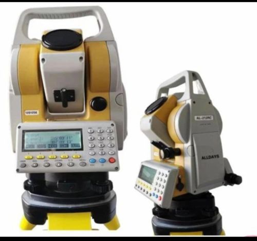
Contact SupplierA Total Station is an advanced electronic surveying and measurement instrument that integrates an electronic theodolite (for measuring angles) with an electronic distance meter (EDM) (for measuring slope distances).
It combines these measurements digitally to calculate precise coordinates (X, Y, Z) of any surveyed point.
Modern total stations are microprocessor-controlled, featuring onboard memory, data recording, and communication interfaces for data transfer to PCs or tablets. They are extensively used in civil engineering, construction, land surveying, and mapping applications for layout, alignment, and topographic data collection.
Some models also include reflectorless (laser) measurement, motorized servo drives, and GNSS integration, allowing quick, accurate, and automated surveys without the need for a prism in many cases.
Key Features
All-in-one measuring system combining EDM and theodolite for angles, distances, and coordinates.
Reflectorless measurement enables surveying without prism targets.
High data accuracy and repeatability suitable for precision construction layouts.
Integrated microprocessor performs onboard calculations — area, volume, coordinates, and stakeout.
User-friendly interface with large display and intuitive software menus.
Data connectivity (USB/Bluetooth) for quick transfer to CAD, GIS, or mapping software.
Rugged construction with IP-rated housing suitable for outdoor site use.
Compatible with third-party software for data processing and mapping.
Layout and alignment of roads, bridges, and buildings.
Earthwork measurement, excavation, and leveling.
Monitoring of structural deformation and movement.
Topographic mapping, land boundary surveys, and contour plotting.
Coordinate and elevation measurement for GIS databases.
Cadastral and property boundary mapping.
Equipment installation alignment in plants and factories.
Pipeline, tunnel, and railway alignment.
Power line and transmission tower positioning.
Land leveling and field boundary planning.
Irrigation project layout and drainage mapping.


Connect with us