Company Information
Ask for more detail from the seller
Contact Supplier
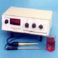
A Digital Planimeter is a precision instrument used to measure the area of two-dimensional shapes on maps, drawings, or plans. It is widely used in civil engineering, architecture, and GIS for accurate area computation from scaled diagrams.
🔧 Digital Planimeter Specifications| Measurement Method | Polar or linear (digital integration) |
| Measuring Range | 0.01 cm² to 10 m² (varies by model and scale) |
| Accuracy | ±0.2% to ±0.5% of the measured value (depending on model and area complexity) |
| Display | Digital LCD display (typically 6–8 digits) |
| Resolution | 0.01 cm² or 0.0001 in² |
| Traceable Arm Length | ~10–30 cm (varies by model; adjustable for different scales) |
| Input Units | cm², m², in², ft² (selectable) |
| Power Supply | Battery operated (typically 1 or 2 × AAA or CR2032 batteries) |
| Operating Time | 100–200 hours depending on battery and usage |
| Auto Power Off | Yes, typically after 5 minutes of inactivity |
| Data Output | Some models include USB or RS-232 ports for PC connection |
| Operating Temperature | 0°C to 40°C |
| Weight | Approx. 300–600 grams |
| Body Material | ABS plastic or aluminum alloy (lightweight and durable) |
| Carrying Case | Included (shock-resistant for field or office use) |
Easy tracing of irregular shapes.
Direct digital readout with minimal human error.
Calibration function for different map scales.
Optional memory for storing multiple measurements.
Some models support built-in conversion factors (e.g., scale ratios).


Connect with us